 |
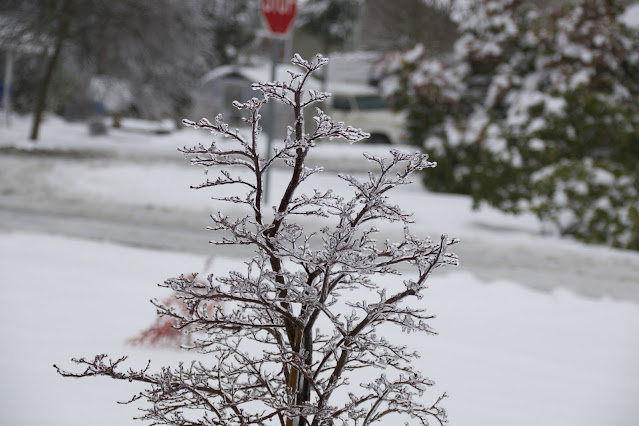
| Freezing rain event in February 2021 Photo by Carl Dinse |
- First Act: Accumulating snow (1-3 inches)
- Second Act: Accumulating freezing rain ( 0.0 to 0.25 inches )
- Gradual warm up starting Friday morning - moving above freezing Friday evening.
- Potential flooding rains over the weekend, with potential for wind.
Temperatures Wednesday night and Thursday night are expected to dive into the teens to low 20's. An approaching Pacific storm is moving in from the southwest. This storm has sub-tropical origins and is very warm, but we have very cold air in place before and as it arrives.
Precipitation is expected to start around Thursday afternoon in the 1pm to 3pm time frame, starting mainly as light snow for the most part. We could see an additional 1-3 inches of snow accumulation before freezing rain begins mixing in during the overnight hours into Friday.
The precipitation that arrives Thursday afternoon is expected to continue non-stop through Saturday and beyond. Around 1am to 3am Friday morning the atmosphere is expected to warm up enough for that snow to change over to rain or mix with rain.
Temperatures at the ground level though are expected to remain below freezing, which means freezing rain. Around a quarter of an inch of freezing rain accumulation is possible from Friday morning through Friday evening.
This kind of event can put a lot of weight on trees and power lines, and it is expected that scattered power outages will occur. Travel will also be extremely difficult as roads become glazed in ice on top of new snowfall.
Once we get through Friday temperatures are expected to warm to the upper 40's or low 50's. It'll feel very nice compared to the temperatures we've had for all of December so far. With the warm air comes a lot of rain.
We have a large atmospheric river approaching that could bring us 4-6 inches of rain through the holiday weekend. Urban flooding and stream flooding will be our next concerns as everything melts and the heavy rains arrive.
There is a lot of uncertainty in our forecast for this transition over to rain and for coming events through the weekend. Snow or freezing rain could linger several hours longer than forecasted.
Another item in the forecast is potential for a wind event. The general trend for the remainder of the month looks to be an active and seasonal pattern. A lot of rain, and potential for one or several wind events on the horizon.
For current weather conditions please visit www.shorelineweather.com


No comments:
Post a Comment
We encourage the thoughtful sharing of information and ideas. We expect comments to be civil and respectful, with no personal attacks or offensive language. We reserve the right to delete any comment.