 |
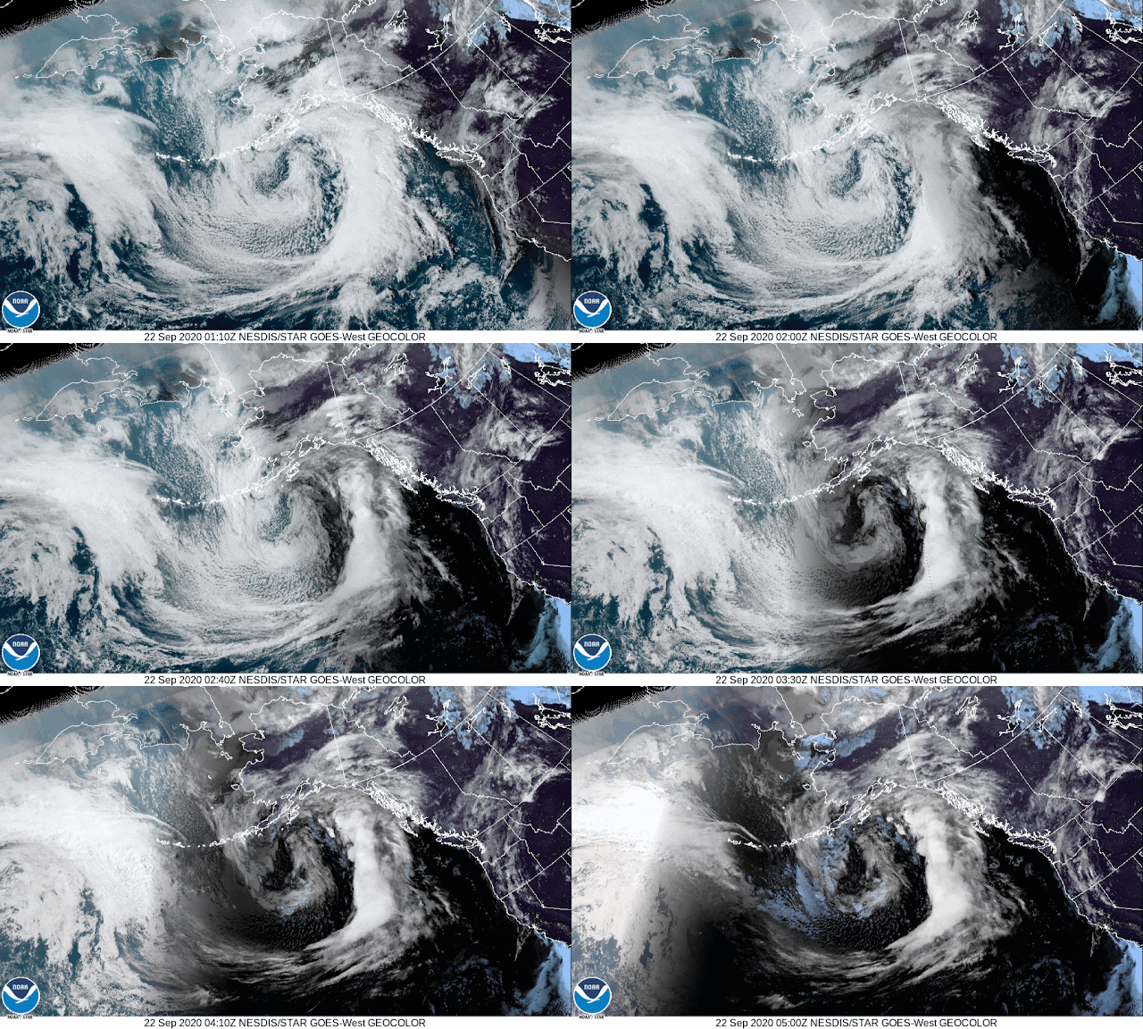
| Satellite image Monday evening from the National Weather Service |
Fall officially starts Tuesday morning September 22, at 6:31am PST. Less than 24 hours later, our first major fall storm is expected to arrive. We're expecting some breezy winds and a lot of rain. Below is the forecast for total rainfall on Wednesday in Western Washington.
 |
| Graphic by the National Weather Service |
For the area that includes Shoreline and Lake Forest Park we are expecting 1 to 1.5" of rainfall between 8pm Tuesday night and 5am Thursday morning. Winds are expected to pick up as well. We could see gusts of up to 30 mph, but for the most part I'm expecting wind gusts between 15-20 mph.
The cause of all this rain can be seen in the animated satellite image at the top. A strong frontal system is expected to bring an atmospheric river event to the region, centered over southwest Washington and northwest Oregon.
Wednesday late night and through Thursday night there is a slight chance of thunderstorms, and another chance of thunder again Friday night. Rain is expected to continue at times Thursday, Friday, and rain is likely Saturday with our first real break from the precipitation Saturday evening.
Temperatures this week will average in the mid 60's for a high, and low to mid 50's for a low until the rain clears.
Sunday looks mostly cloudy with a chance of showers. Our first shot at a dry and sunny day appears to be Monday next week. Longer range forecasts suggest that next week may be a mostly sunny week, with high temperatures returning to the low 70's.
Bottom Line: One of the biggest concerns with an early heavy rain event is debris blocking storm drains. This can cause local standing water and urban flooding. Adopt a storm drain near you to monitor and keep clear. This will help prevent small urban flooding on local roadways and sidewalks. Scattered isolated power outages are possible if winds do get gusty.
For current weather conditions visit www.shorelineweather.com


Very thorough assessment, thank you! Especially like "with our first real break from the precipitation Saturday evening" as our daughter's OUTDOOR wedding is at 5PM SAT.!!
ReplyDeleteI have some bad news for that wedding, Saturday's rain event timing has shifted, and we are now expecting rain through the evening and into Sunday.
ReplyDelete